Lake Petén Itzá Scientific Drilling Project
Project Acronym: PISDP | State: Completed | Expedition ID: 5033
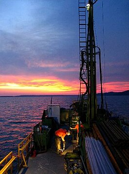
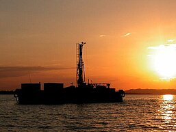
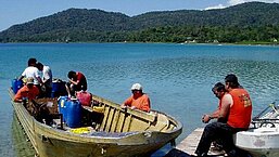
GLAD800 was used to drill a series of sites in Lake Petén Itzá, northern Guatemala, to recover sedimentary sequences along a depth transect from ~30 m to near the deepest point (~150 m) in the lake. Six primary and four alternative drilling sites have been identified on the basis of two detailed seismic surveys.
Keywords: Central America, Guatemala, Lake Peten-Itza, Climate Change, Global Environment, Lake Drilling, Maya Clay, Neotropics, Paleoclimatology, Paleoecology
Cores are stored at University of Minnesota at Minneapolis, Continental Scientific Drilling Facility, USA

Project Management
Contact Person
Lead PIs
- Flavio Anselmetti – University of Bern
- Daniel Ariztegui – Universite de Geneve
- Mark Brenner – University of Florida
- Jason Curtis – University of Florida
- James Hall – Carnegie Institution for Science
- Gerald Haug – Max-Planck-Institute Mainz for Chemistry
- Judith McKenzie – Swiss Federal Institute of Technology Zurich
CoPIs
Co-PIs: No data found
Project Details
Project Description
- Title:
- Lake Peten Itza Scientific Drilling Project (PISDP)
- Proposed in:
- 2004
- Current State:
- Completed
- Proposal abstract:
- n.a.
- Geologic age:
- Pleistocene
- Number of drillsites (drillholes):
- 7(21)
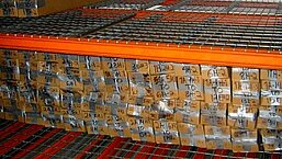
- Drilled length:
- 1400.68 m (29 wellholes/hole attempts/hole deepenings/sidetracks total)
- Cored length:
- 1400.68 m
- Core recovered, length:
- 1400.68 m
- Core recovered length / Cored length:
- 100.0%
- Core recovered / Drilled length:
- 100.0%
- Expedition #
- 5033
- Location
- Central America, Guatemala, Lake Peten Itza, Guatemala
- Coordinates
- 17.0000, -90.0000
- Status
- Completed
Project Location
Project Timeline
Drilling
1 February - 31 March 2006
Full Proposal Approved
Workshop Held
17 - 21 August 2003 in Flores, Guatemala